Amazon Deforestation Falls to Its Lowest Level Since Records Began
Key Points
- Between August 2025 and July 2026, 3,335 square kilometers of the Brazilian Amazon were cleared, about 1,288 square miles.
- That is 41.8% less than the 5,731 km2 of the year before, and the lowest rate in a series that began in 1988.
- Clearing in the Cerrado came to 5,516.69 km2, down 23.8%, the lowest in a series that began in 2001.
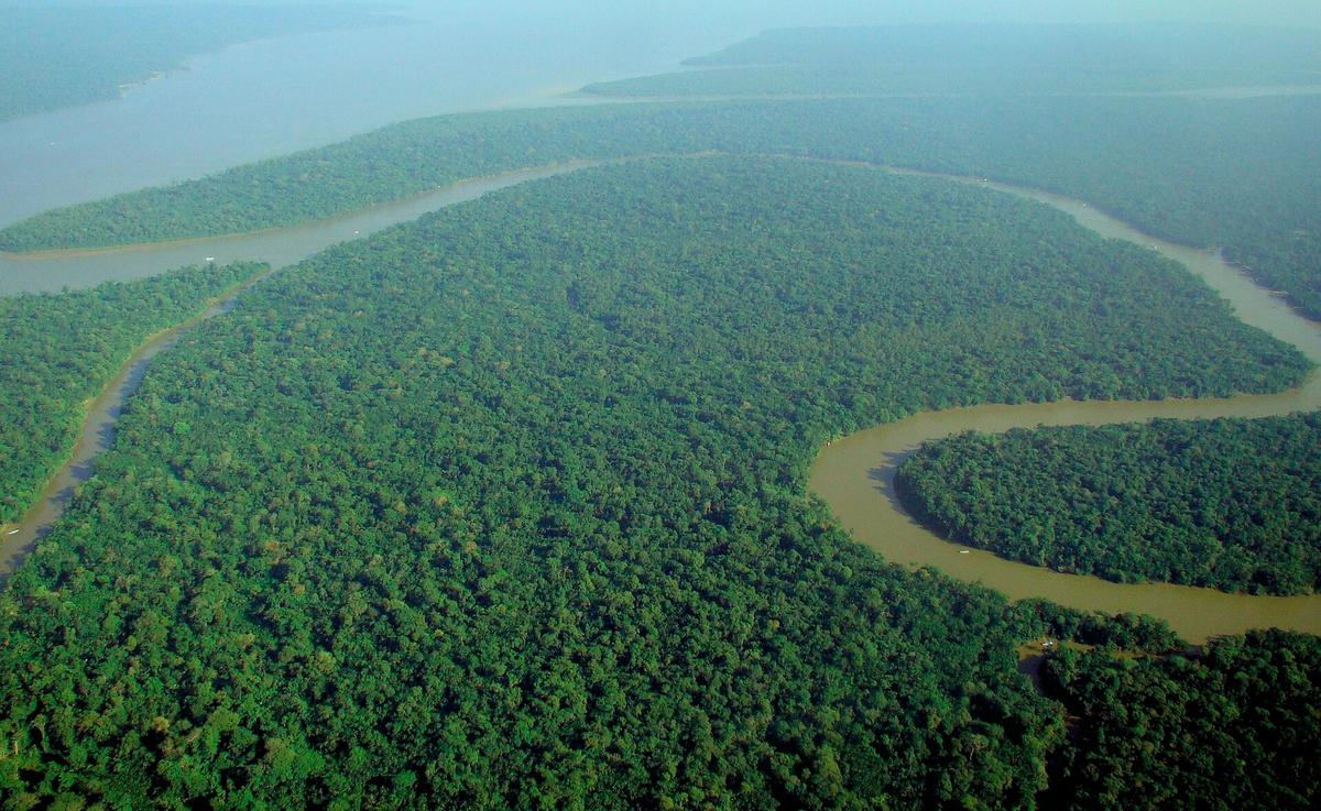

On 16 October 2026, Brazil's federal government and its National Institute for Space Research (INPE) released the year's official deforestation rates. In the Brazilian Amazon, 3,335 square kilometers of forest were cleared between August 2025 and July 20261, about 1,288 square miles. That is 41.8% less than the 5,731 km2 recorded the year before1 (about 2,213 square miles), and INPE calls it the lowest rate in a historical series that began in 19881.
The previous low came in 2012, at 4,571 km21 (about 1,765 square miles), so the new figure undercuts it by more than a thousand square kilometers. For a sense of scale, Mongabay notes the 2026 total is "an area smaller than the Spanish island of Mallorca"3.
What the satellites count
PRODES is the INPE system behind the number. It maps the annual removal of native vegetation in every Brazilian biome from satellite images5, and its output is the official deforestation data for the country. Each PRODES year runs from 1 August to 31 July1, which is why a figure called 2026 covers months from 2025.
PRODES counts the complete removal of primary forest cover by clear-cutting4, including land left as bare soil, mining areas and flooded forest, plus the final stage of progressive degradation, when the canopy is lost entirely. The count includes both authorized and unauthorized clearing1, so deciding what was legal is a separate job for the agencies that check permits. Regrowth is not subtracted either, because the annual rate is not a balance that discounts restoration1.
The Amazon figure released each October is an estimate based on priority images1, and the consolidated rate, built from every image of the region, is normally due in the first half of the following year1. Last year's arrived in August 2026. INPE's estimate in October 2025 was 5,796 km2, an 11.08% drop from 20245, and the consolidated number published in August 2026 settled at 5,731 km2, a 12.07% drop from the 6,518 km2 of 20244.
Where the drop showed up
The three states with the most clearing all fell by close to half. Pará went from 2,064 km2 to 1,130 km21 (about 797 to 436 square miles), Mato Grosso from 1,593 km2 to 849 km2 (about 615 to 328 square miles), and Amazonas from 979 km2 to 525 km2 (about 378 to 203 square miles). The steepest percentage falls were in Tocantins, down 73.3%, and Amapá, down 52.9%1.
The Cerrado, the vast savanna south of the Amazon, had its own record. Clearing there came to 5,516.69 km2, down 23.8% from 7,235.27 km21 (about 2,130 square miles, down from 2,794). That is the lowest value in the Cerrado series, which began in 20011, below the previous low of 6,319 km2 (about 2,440 square miles) set in 2019. Unlike the Amazon number, the Cerrado figure is already the consolidated rate1, because the mapping covered the whole biome.
PRODES and DETER
INPE runs a second satellite system, DETER, and the two answer different questions. DETER produces alerts in near real time to guide enforcement1, while PRODES is the official annual survey. The methods differ, and adding up DETER alerts does not reproduce the PRODES result1.
The alerts pointed the same way months earlier. In August 2026, DETER showed 2,874.38 km2 under alert from August 2025 to July 20266 (about 1,110 square miles), down from 4,495 km2 the cycle before and the lowest value since the series began in 20166.
Fire is measured separately again. INPE points out that October's fires fall outside the PRODES period1, and that a fire can badly damage forest or burn already cleared land without all of the burned area being classified as deforestation.
Mongabay also points to a super El Niño forming in the Pacific3. El Niño years are linked with drought in the southern Amazon, and Mongabay adds that fires usually rise in the year after a strong one3.
A long way from 2004
Citing IBGE, Brazil's statistics agency, Agência Brasil reported in 2015 that annual clearing in the Legal Amazon climbed from 11,030 km2 in 1991 to 27,772 km2 in 20047 (about 4,259 and 10,723 square miles), before the trend turned downward toward the 2012 low. The 2026 rate is about an eighth of the 2004 figure.
Guinness World Records puts the Amazon rainforest at between around 6.24 million and 6.56 million square km8 (2.4 million to 2.53 million square miles), across nine South American countries, and Brazil is home to approximately 60 percent2 of it. Mongabay reports that deforestation now amounts to about 15% of the biome3, based on work by the nonprofit Amazon Conservation, and that scientists estimate the rainfall system driven by the forest could fail if that share reaches 20 to 25%3.
Money for monitoring
The government's release describes a federal strategy that combines satellite monitoring, enforcement, land-use planning and support for sustainable production1. One of the funding streams it names is the Amazon Fund, a REDD+ mechanism that raises donations for non-reimbursable investments9 to prevent, monitor and combat deforestation in the Brazilian Amazon. Brazil's development bank, BNDES, manages the fund9.
As of October 2026, the fund had 160 approved projects and R$7.8 billion committed1 in inflation-adjusted Brazilian reais, with projects in 75% of the municipalities of the Legal Amazon. That is about US$1.53 billion at the Central Bank of Brazil's PTAX rate of 5.0826 reais per dollar on 16 October 202610. BNDES has also approved R$147.6 million for SIM-Biomas1, a project announced the same day, about US$29 million at the same rate. The project will use artificial intelligence to combine PRODES and DETER and produce PRODES data during the year, extend DETER to the Caatinga, Atlantic Forest and Pampa, and sharpen burned-area mapping from 1 kilometer outside the Cerrado to 30 meters in every biome1.
Trivia
- What does the name PRODES stand for? It stands for Projeto de Monitoramento do Desmatamento na Amazônia Legal por Satélite6, the project for satellite monitoring of deforestation in the Legal Amazon.
- Which European satellites does INPE draw on for PRODES? It uses data from the Sentinel satellites of the European Space Agency4, with the images prepared by INPE's Brazil Data Cube project.
- Which two private-sector agreements lean on PRODES data? The Soy Moratorium and the beef supply chain's conduct adjustment agreement4, among others.
- Which Amazon state's clearing barely moved in 2026? Roraima, which went from 285 km2 to 286 km2, up 0.4%1 (about 110 square miles both years).
- Which state cleared the most Cerrado in the 2026 count? Maranhão, with 1,718.59 km21 (about 664 square miles).
- What legal act created the Amazon Fund, and when? Decree No. 6,527, dated August 1, 20089.
- How old did INPE turn in August 2026? It turned 65 on August 36, and that year's DETER figures were presented the same week.
Sources
- Brasil alcança menores taxas de desmatamento da série histórica na Amazônia e no Cerrado, Instituto Nacional de Pesquisas Espaciais (INPE), gov.br, 16 October 2026. Accessed October 17, 2026.
- Deforestation in Brazil Amazon hits nearly four-decade low, AFP via France 24, 16 October 2026. Accessed October 17, 2026.
- Rhett Ayers Butler, Amazon deforestation falls 42% to a record low, Mongabay, 16 October 2026. Accessed October 17, 2026.
- Sistema do INPE aponta 5.731 km2 de desmatamento na Amazônia em 2025, Instituto Nacional de Pesquisas Espaciais (INPE), gov.br, 18 August 2026. Accessed October 17, 2026.
- Dados do Prodes apontam redução no desmatamento na Amazônia e no Cerrado brasileiros, Instituto Nacional de Pesquisas Espaciais (INPE), gov.br, 30 October 2025. Accessed October 17, 2026.
- Marcelo Brandão, Desmatamento na Amazônia cai 36,87% no último ano, Agência Brasil, 7 August 2026. Accessed October 17, 2026.
- Vinícius Lisboa, Em 16 anos, desmatamento da Amazônia Legal foi quase o tamanho de SP, Agência Brasil, 19 June 2015. Accessed October 17, 2026.
- Largest tropical rainforest, Guinness World Records. Accessed October 17, 2026.
- Amazon Fund, Amazon Fund (BNDES). Accessed October 17, 2026.
- Cotação do dólar (PTAX), 16 October 2026, Banco Central do Brasil, Olinda open data API. Accessed October 17, 2026.